Posts

Showing posts from November, 2021

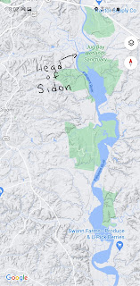
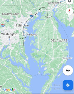
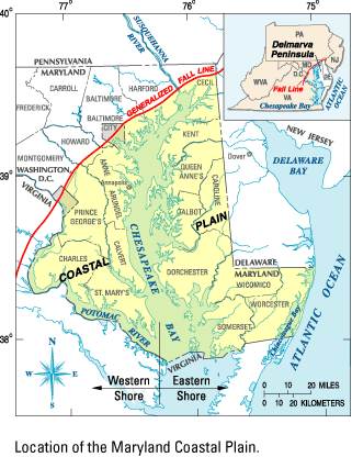
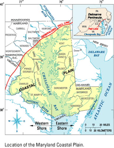
Cities by the East Sea

The purpose of the cities by the east sea take on a new and important meaning with this model. It becomes clear why Moroni finds it critical to invest time and money building "cities by the east sea" during war time. These cities serve as a defense from the Lamanites coming across the sea. The Lamanites are on both the east shore of the Chesapeake (land of first inheritance) and the west shore, below the land of Zarahemla. Although the text doesn't say exactly, they would most likely be found on the west of the Potomac river (west sea). This would be how the Lamanites could attack from the "west sea."   (Add map)

East and West Seas

Image
  The terms “east sea” and “west sea” are not proper names, but seas to the east or west of the place being described. This means the same sea can be either the east sea or the west sea depending on where you are standing. For example, on the Delmarva peninsula where the city of Nephi and the city of Bountiful are located, the Chesapeake Bay would be the west sea. In the land of Zarahemla, the Chesapeake Bay would be the east sea and the Potomac River the west sea. This land being the location of the Book of Mormon, how else could Mormon describe those seas short of giving the seas proper names? An important feature to note with all these seas is that it results in the land southward being “nearly surrounded by water” just as it says in Alma chapter 22.                     A Piscataway father and son look out across the Potomac River (west sea). From the book Meet Naiche: A Native Boy From The Chesapeake Bay Area.

Map of "Land Southward"

Image
 

Gadianton Robbers

Image
 3 Nephi 4:1 "And it came to pass that in the latter end of the eighteenth year those armies of robbers had prepared for battle, and began to come down and to sally forth from the hills, and out of the mountains, and the wilderness, and their strongholds, and their secret places, and began to take possession of the lands, both which were in the land south and which were in the land north, and began to take possession of all the lands which had been deserted by the Nephites, and the cities which had been left desolate." Traveling north from the land of Zarahemla leads to the hills of the piedmont and then to the Appalachian mountains. This would be the area of the Gadianton robbers. Note that even though it's in the land northward, it's not the same "land northward" the Nephites settle and eventually flee to at the end of the Book of Mormon, that land being on the east side of the Susquehanna.   

River Sidon

Image
  I n 1608, Captain John Smith explored the Chesapeake Bay and sailed up the Patuxent River. His claim that "Heaven and Earth never agreed better to frame a place for Man's habitation” lured many English colonist to America. (1) Another major geographical feature that must be reconciled in the land southward is the river Sidon. We propose the Patuxent River as the river Sidon. Near the Patuxent River are hills and valleys on both the east and west side of the river, consistent with the text in the Book of Mormon and large enough to hide armies (Alma 43).  One common conclusion is that the river Sidon must flow south to north because the “head” is near Manti and we know that the river Sidon also flows past Zarahemla, which is north of Manti. This is assuming “head” means the beginning of the river. Another definition of “head” found in the 1828 Noah Webster’s Dictionary is “conflux.” In the same dictionary “conflux” is defined as “ a flowing together; a meeting of two or more c

Narrow Pass

Image
  The narrow pass is distinct from the “narrow neck of land.” It is common in Book of Mormon models to have the narrow pass simply a passage through the narrow neck, since both lead to the land northward. This model proposes that the "narrow pass" refers to the way into the land northward from the western shore of the Chesapeake Bay; in other words, from the land of Zarahemla. Having the narrow pass in this location explains how Teancum and his army, who were coming from Bountiful (which is below the narrow neck), could head Morianton and his people by the narrow pass. Teancum’s army “did not head them until they came into the borders of the land Desolation; and there they did head them, by the narrow pass which led by the sea into the land northward, yea by the sea on the west and on the east” (Alma 50:34). This is only logical if Teancum’s army comes from Bountiful, located below the narrow neck, and Morianton’s people are coming from the “western shore” up through the na

A Sea that Divides the Land

Image
  In the previous post, we gave an overview of the land of the Book of Mormon and proposed reasonable locations for the narrow neck of land, Ripliancum, and the land of many waters.  Another major feature that must be reconciled is a "sea that divides the land" (Ether 10:20). This USGS map below shows the fall line, which separates the land “northward” from the land “southward.” It shows that the Chesapeake Bay fits nicely with the description of the “sea that divides the land.” The term “land” refers to the land southward. Notice how the fall line continues on the west side of the Susquehanna river. Below the fall line, on the west side of the “sea that divides the land,” is the land of Zarahemla. One corroborating verse is found in Ether 9:31. It describes poisonous serpents fleeing toward the “land southward, which was called by the Nephites Zarahemla.” Interestingly, it doesn’t say they fled to Bountiful, but to the west side of the land southward, the land of Zarahemla

The Land of the Book of Mormon

Image
"It has been my experience that most members of the Church of Jesus Christ of Latter-day Saints, when confronted with a Book of Mormon geography, worry about the wrong things. Almost invariably the first question that arises is whether the geography fits the archaeology of the proposed area. This should be our second question, the first being whether the geography fits the facts of the Book of Mormon- a question we all can answer without being versed in American archaeology. Only after a given geography reconciles all of the significant geographic details given in the Book of Mormon does the question of archaeological and historical detail merit attention. The Book of Mormon must be the final and most important arbiter in deciding the correctness of a given geography; otherwise, we will be forever hostage to the shifting sands of expert opinion."                      -John E. Clark(1)   The goal of this site is to show how one model "reconciles all the significant geogra