Posts

Narrow Pass

Image
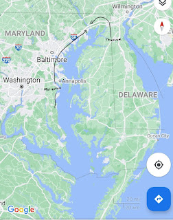
  The narrow pass is distinct from the “narrow neck of land.” It is common in Book of Mormon models to have the narrow pass simply a passage through the narrow neck, since both lead to the land northward. This model proposes that the "narrow pass" refers to the way into the land northward from the western shore of the Chesapeake Bay; in other words, from the land of Zarahemla. Having the narrow pass in this location explains how Teancum and his army, who were coming from Bountiful (which is below the narrow neck), could head Morianton and his people by the narrow pass. Teancum’s army “did not head them until they came into the borders of the land Desolation; and there they did head them, by the narrow pass which led by the sea into the land northward, yea by the sea on the west and on the east” (Alma 50:34). This is only logical if Teancum’s army comes from Bountiful, located below the narrow neck, and Morianton’s people are coming from the “western shore” up through the na...
A Sea that Divides the Land

Image
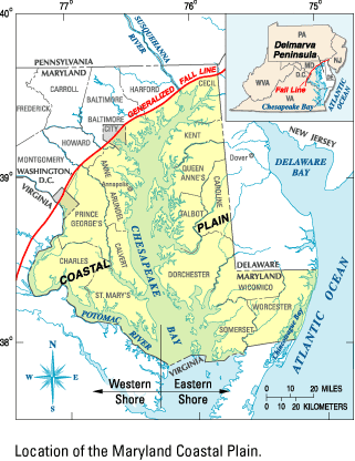
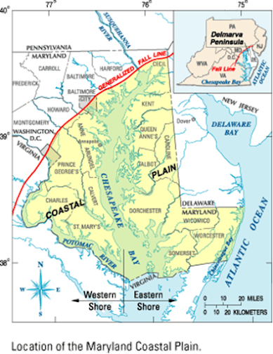
  In the previous post, we gave an overview of the land of the Book of Mormon and proposed reasonable locations for the narrow neck of land, Ripliancum, and the land of many waters.  Another major feature that must be reconciled is a "sea that divides the land" (Ether 10:20). This USGS map below shows the fall line, which separates the land “northward” from the land “southward.” It shows that the Chesapeake Bay fits nicely with the description of the “sea that divides the land.” The term “land” refers to the land southward. Notice how the fall line continues on the west side of the Susquehanna river. Below the fall line, on the west side of the “sea that divides the land,” is the land of Zarahemla. One corroborating verse is found in Ether 9:31. It describes poisonous serpents fleeing toward the “land southward, which was called by the Nephites Zarahemla.” Interestingly, it doesn’t say they fled to Bountiful, but to the west side of the land southward, the land of ...

The Land of the Book of Mormon

Image
"It has been my experience that most members of the Church of Jesus Christ of Latter-day Saints, when confronted with a Book of Mormon geography, worry about the wrong things. Almost invariably the first question that arises is whether the geography fits the archaeology of the proposed area. This should be our second question, the first being whether the geography fits the facts of the Book of Mormon- a question we all can answer without being versed in American archaeology. Only after a given geography reconciles all of the significant geographic details given in the Book of Mormon does the question of archaeological and historical detail merit attention. The Book of Mormon must be the final and most important arbiter in deciding the correctness of a given geography; otherwise, we will be forever hostage to the shifting sands of expert opinion."                      -John E. Clark(1)   The goal of this...